Commission Agenda Item No. 8
Presenter:
Ted Hollingsworth
Action
Acquisition of Easement – Jefferson County Drainage District No. 7
Access to Levees for Hunter Parking at the J.D. Murphree WMA
January 23, 2014
I. Executive Summary: Texas Parks and Wildlife Department has worked out an arrangement with the Jefferson County Drainage District No. 7 to allow parking on District levees for hunters on the J.D. Murphree Wildlife Management Area.
II. Discussion: The 24,498-acre J.D. Murphree Wildlife Management Area (WMA), located on the Chenier plain and marshes of the southeast Texas coast, is a very popular destination for waterfowl hunters. Hunters often arrive hours before sunrise in anticipation of gaining access to their favorite locations. Hunters who arrive before entrance gates are open often park and wait on the shoulder of State Highway 73. With narrow shoulders and a 75 mile-per-hour speed limit, staff of the WMA has long been concerned for the safety of these early arrivals.
Levees adjacent to the WMA are topped by asphalt access roads and are owned and maintained by the Jefferson County Drainage District No. 7. Staff has worked with the District to craft an inter-governmental agreement that grants an easement to TPWD to allow hunters at the WMA to park their vehicles on these levees. Hunters will start taking advantage of this agreement during the current waterfowl hunting season.
III. Recommendation: The staff recommends the Texas Parks and Wildlife Commission adopt the following motion:
“The Texas Parks and Wildlife Commission authorizes the Executive Director to enter into an inter-governmental agreement with Jefferson County Drainage District No. 7 that grants an easement to TPWD to allow hunters at the J.D. Murphree Wildlife Management Area to park on District land while hunting or preparing to hunt on the Wildlife Management Area.”
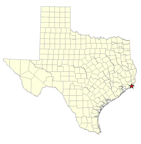
Commission Agenda Item No. 8
Exhibit A
Location Map for J.D. Murphree WMA in Jefferson County
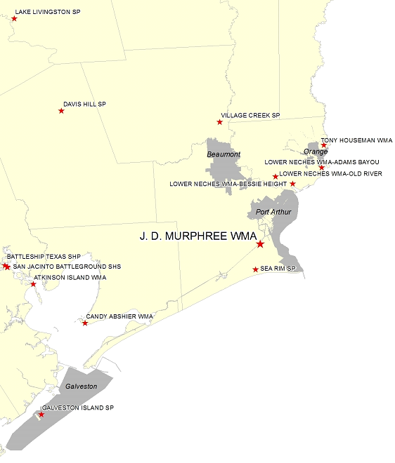
Commission Agenda Item No. 8
Exhibit B
Vicinity Map for the J.D. Murphree WMA – 5 Miles South of Port Neches
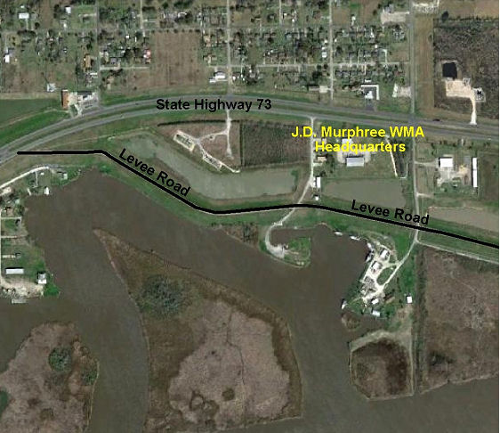
Commission Agenda Item No. 8
Exhibit C
Site Map Showing J.D. Murphree Headquarters and Levee Road