Ecologically Significant River and Stream Segments
Bastrop Bayou
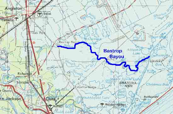
Figure 6. Map Location of Bastrop Bayou
Adapted from USGS Houston, Texas. 1975. Original scale
1:250,000
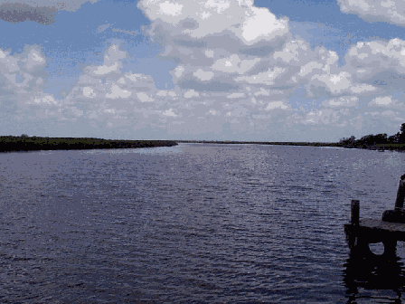
Figure 7. Bastrop Bayou west of FM 523
Bastrop Bayou
Bastrop Bayou is a scenic coastal waterway fringed by extensive freshwater wetland habitat. The bayou rises in the central part of Brazoria County and flows deeply in a southeasterly direction for 13 miles where it empties into Austin Bayou and ultimately Bastrop Bay.3 Like Austin Bayou, Bastrop Bayou provides valuable habitat for endangered or threatened shorebirds as well as waterfowl, grassland species, and birds of prey. These include geese, sandhill cranes, sedge wrens, grasshopper sparrows, white-tailed kites, and white-tailed hawks. In addition to numerous bird watching opportunities, the bayou also provides outdoor opportunities in the form of water related activities to local residents.3 The ecologically significant segment is from the confluence with the Intracoastal Waterway in Brazoria County to the FM 523 crossing in Brazoria County. This segment is within TNRCC stream segment 1105.
(1) Biological Function- extensive freshwater wetland habitat that displays significant overall habitat value.1
(2) Hydrologic Function- extensive freshwater wetlands perform valuable hydrologic function relating to water quality.
(3) Riparian Conservation Area- fringed by the Brazoria National Wildlife Refuge and is part of the Great Texas Coastal Birding Trail.
(4) Threatened or Endangered Species/Unique Communities- designated as an internationally significant shorebird site by the Western Hemisphere Shorebird Reserve Network, provides habitat for the wood stork, reddish egret, and white-faced ibis.23
(Back)