- Trans Pecos
- High Plains/Panhandle
- Cross Timbers
- Hill Country
- Post Oak Savannah
- Pineywoods
- Oak Prairie
- South Texas Plains
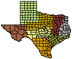
Wildlife Division District Map
Cross Timbers and Prairies Ecological Region
The Cross Timbers and Prairies Ecological Region of Texas encompasses approximately 26,000 square miles in north and central Texas and is the primary ecological region of Northcentral Texas. It is bordered on the east by the Blackland Prairie Ecological Region, the west by the Rolling Plains Ecological Region, and extends south and southwestward to the Llano Basin and Edwards Plateau Ecological Region in central Texas. It can be further subdivided into four ecological or vegetative sub-regions: East Cross Timbers, Fort Worth Prairie, Lampasas Cut Plain, and West Cross Timbers. This broad vegetative region also extends northward into Oklahoma and southern Kansas. (Diggs et. al. 1999).
History
Vegetation on the landscape of the Cross Timbers and Prairies Ecological Region of Northcentral Texas has undergone significant changes over the past 150 years. Early travelers through north Texas coined the name "Cross Timbers" by their repeated crossings of these timbered areas that proved to be a barrier to their travel on the open prairies to the east and west. The location of the East and West Cross Timbers was well known by these early travelers who used them as points of reference for travel. In 1772, De Mezieres (Dyksterhuis 1948) stated that from the Brazos River north "…one sees on the right a forest (East Cross Timbers) that the native appropriately call the Grand ForestæSince it contains some large hills, and because of the great quantity of oaks, walnuts, and other large trees, it is a place difficult to cross…On the farther edge of this range, or forest, one crosses plains having plentiful pasturage...;" and in 1778 "...I crossed the Colorado and Brazos, where there are...an incredible number of Castilian cattle, and herds of mustangs that never leave the banks of these streams. The region from one river to the other, is no less bountifully supplied with buffalo, bear, deer, antelope, wild boars, partridges, and turkeys."
In 1840, Col. Stiff (Dyksterhuis 1948) who approached the Cross Timbers of Texas from the western prairies stated, "In turning to the northeast, something much resembling an irregular cloud is dimly seen. This is a skirt of woodland…called the Cross Timbers (West Cross Timbers)…Whether this was once a beach of a mighty lake or a sea we must leave to the geologist to determine." Kendall (1841) stated that on July 21, 1841, "We are now fairly within the limits of the Cross Timbers…The immense western prairies are bordered, for hundreds of miles on their eastern side, by a narrow belt of forest land, well known to hunters and trappers under the above name." He stated, "The growth of timber is principally small gnarled, post oaks and black jacks, and in many places the traveler will find an almost impenetrable undergrowth of briers and other thorny bushes."
Marcy (1866) stated of the Cross Timbers, "At six different points where I have passed through it (Cross Timbers), I have found it characterized by the same peculiarities; the trees, consisting principally of post-oak and blackjack, standing at such intervals that wagons can with out difficulty pass between them in any direction. The soil is thin, sandy, and poorly watered."
Other historic accounts by early travelers in north and central Texas record a much different Texas landscape in many areas that is difficult for us to imagine today. In 1854, W. B. Parker who traveled with a survey party of the United States Government to locate and survey lands for Indian reservations in north Texas noted, "The timber is a short, stunted oak, not growing in a continuous forest, but interspersed with open glades, plateaus, and vistas of prairie scenery, which give a very picturesque and pleasing variety:" On crossing the Upper (Western) Cross Timbers west of present day Gainesville in Cooke County, Parker stated, "Below, stretching as far as the eye could reach, lay the apparently interminable forest of the Cross Timbers, like a barrier, on passing which we were to be shut out from civilization, its joys and cares, for many, many weeks."
In May of 1854, J. Pope's report on the exploration of the region for a route for the Pacific Railroad stated "….but by far the richest and most beautiful district of country I have ever seen, in Texas or elsewhere, is that watered by the Trinity and its tributaries. Occupying east and west a belt of one hundred miles in width, with about equal quantities of prairie and timber, intersected by numerous clear, fresh streams and countless springs, with a gently undulating surface of prairie and oak openings, it presents the most charming views, as of a country in the highest state of cultivation, and you are startled at the summit of each swell of the prairie with a prospect of groves, parks and forests, with intervening plains of luxuriant grass, over which the eye in vain wanders in search of the white village or the stately house, which seem alone wanting to be seen".
Dyksterhuis (1948) described the Western Cross Timbers as an area "…extending 150 miles south from the northern limits near the Red River, curving westward at the southern extremity. The Main Belt and the Fringe together, though much interrupted, occupy the major portion of an area 150 miles long, varying in width from about 25 miles at the north to about 110 miles at the south."
Nearly all surface rocks of the North Central Texas were deposited during the Cretaceous Period (145-65 millions years ago). Some exposed surface formations in the western part of the West Cross Timbers date from the 300-million-year-old Pennsylvanian Period. Soils of the East and West Cross Timbers were developed on sandy Cretaceous Woodbine and Trinity strata. In the Fort Worth Prairie and Lampasas Cut Plain, shallow soils were formed over Cretaceous limestone parent materials. Elevations across the region range from 500 to 1,500 feet. Soils throughout the region are not uniform. Consequently, plant communities change dramatically within short distances resulting in different land use potential for livestock grazing, farming, wildlife management, or other uses.
Although habitat for wildlife is present throughout the ecological region as a whole, populations vary considerably within sub-regions. The diversity and configuration of plant communities on the landscape influence wildlife populations. Other factors such as fragmentation of once continuous habitat into smaller land holdings, competition for food and cover with livestock, conversion of woodland habitat to improved pastures or other agricultural enterprises, urban and rural developments, and lack of proper wildlife and habitat management also determine the density and diversity of wildlife.
The East Cross Timbers - In Northcentral Texas, the East Cross Timbers vegetative sub-region is a narrow strip of timbered country extending from eastern Cooke County on the Red River south to western Hill County and includes portions of Denton, Tarrant, Johnson, and Hill counties. Early travelers called this region the Monte Grande (Grand Forest) and later the Lower Timbers. Its location was well known and served as a landmark reference for travelers. Today, few large tracts of undisturbed woodlands remain in the East Cross Timbers which is perhaps the most fragmented vegetative region in Texas.
Soils are slightly acidic, sandy or sandy loam, and produce woodlands dominated by post oak, blackjack oak, cedar elm, hickory, osage orange, eastern red cedar, mesquite, bumelia, hawthorn, greenbriar, and a variety of other brush and grass species.
Many woodland areas in this region have been cleared for tame-grass pastures, croplands, horse and cattle ranches, and urban and rural developments, including portions of the cities of Denton, Dallas, Fort Worth, and other expanding inter-city and rural communities. Considerable urban growth and expansion throughout this region will continue to impact wildlife habitat resources in the future. Wildlife management in the East Cross Timbers will prove to be challenging to landowners and will require innovative approaches to management of the habitat resources found there.
Fort Worth Prairie - In Northcentral Texas, the Fort Worth Prairie vegetative sub-region is located between the East and West Cross Timbers sub-regions, extending from western Cooke and eastern Montague counties on the north, southward to northern Edwards Plateau and includes portions of Denton, Wise, Tarrant, Parker, Johnson, and Hood counties. Terrain of the mostly treeless vegetative region, located north of the Brazos River, is characterized by gently sloping flat surface features with thin soil over hard layers of resistant limestone. Underlying layers of limestone slope eastward with the exposed ends of younger layers forming escarpments or "cuestas" that produce the scenic topography typical for the area.
Vast tall-grass native prairies once covered this region. Most grasslands have been degraded and remain only as remnants where shallow soils prevented cultivation. Considerable farming and livestock grazing operations were initiated by early settlers in areas of sufficient soil depth in this sub-region. Extensive areas are still used for livestock grazing, but climax plant communities have been altered. Urban sprawl and developments have rapidly extended into the sub-region as the human population to increased in the region. These landscape changes will have long lasting consequences for wildlife and habitat resources in this sub-region.
Lampasas Cut Plain - In Northcentral Texas, the Lampasas Cut Plain vegetative sub-region lies south and southwest of the East and West Cross Timbers and Fort Worth Prairie, extending to the upper reaches of the Edwards Plateau. Counties found in the sub-region include parts of Somervell, Erath, Hamilton, Comanche, Brown, Mills, Bosque, Hill, and McLennan counties. Most of this region is underlain by various limestone formations.
Exposed flat topped buttes and escarpments capped by Edwards limestone which have been eroded over most of the region. The Lampasas Cut Plain is more rugged than the Fort Worth Prairie, being bisected by numerous low buttes and mesas formed by extensive erosion during it geologic formation. There are extensive regions of grasslands and valleys with higher, narrow, often wooded mesa-like divides. Soils at the surface, consequently, support the growth of plants adapted to higher alkalinity, such as live oak and juniper. Historical records indicate much of this region existed as a grassland or open live oak savannah that supported herds of bison and other herbivores dependent on the tall grasses that dominated the region.
The rich loam soils now support agricultural croplands that produce cotton, corn, oats, wheat, sorghum, milo, and other crops. Much of the land in this region is also used for livestock ranching for cattle, sheep, and goats. Habitat for white-tailed deer, Rio Grande turkey, bobwhite quail, mourning doves, fox squirrels, rabbits and a variety of nongame wildlife species is found here.
After the introduction of domestic livestock, farming operations, and control of wildfires, the landscape of much of the Lampasas Cut Plain changed. Land use practices associated with these and other ventures created a landscape that experienced invasion and domination in some areas by problematic brush species such as mesquite, Ashe juniper and other native woody species.
Overgrazing by livestock and elimination of naturally occurring fire also reduced native grass cover and allowed the invasion of other less desirable annual grasses and forbs. This change in plant life on the landscape, however, has increased habitat for a number of wildlife species and can be viewed as a positive result of historical land use in the Lampasas Cut Plain.
Management of habitat for white-tailed deer and other wildlife species in the Lampasas Cut Plain sub-region can be financially rewarding to landowners and land managers. White-tailed deer numbers exist at or substantially above habitat potential (the ability of native habitat to support deer without sustaining long-term degradation or loss of plant species) in much of this sub-region. Farm and ranch size is relatively large, making accomplishment of land management strategies for wildlife and habitat both productive and feasible.
West Cross Timbers - In Northcentral Texas, the West Cross Timbers vegetative sub-region, located immediately west of the Fort Worth Prairie and north of the Lampasas Cut Plain, extends from the Red River in Montague and Cooke counties south and southwestward to the Lampasas Cut Plain and west to the Rolling Plains. This zone also includes portion of Archer, Clay, Wise, Young, Throckmorton, Shackelford, Jack, Tarrant, Parker, Palo Pinto, Stephens, Callahan, Eastland, Erath, Hood, Somervell, Johnson, Hamilton, Comanche, Mills and Brown counties. This region was called the Upper Timbers by early travelers due to its higher elevation.
This sub-region has a complex geologic history, resulting in a variety of soil types, terrain features, and vegetative plant communities. The terrain in most of this sub-region is very hilly, with sandstone and limestone escarpments, steep slopes, and irregular surface features. Watersheds of the Red, Colorado, Trinity and Brazos Rivers cross the region from northwest to southeast. Exposed sandstone rocks and boulders dominate landscape features in many areas. Sandy loam soils are productive for agricultural crops such as peanuts, small grains, fruit trees, sorghum, pecans, and truck crops. In other areas, limestone surface formations and shallow clay soils support grasslands and vegetative plant communities adapted to higher alkalinity.
Features of the Fort Worth Prairie extend into the West Cross Timbers along the eastern boundary, forming irregular ecotones of diverse tree and brush species common to both zones. Extensive open grasslands and brushy rangelands occur in the West Cross Timbers sub-region. In the western counties, where the average size of land tracts increases, cattle ranching is the predominant land use. Winter agricultural forage crops such as wheat and oats are commonly planted.
Post oak-blackjack oak woodlands characterize much of the West Cross Timbers. Other associated woody species include shin oak, Spanish oak, live oak, Texas ash, mesquite, osage orange, Ashe juniper, eastern red cedar, cedar elm, skunkbush sumac, elbowbush, lotebush, tasajillo, rough-leafed dogwood, flame-leaf sumac, hawthorn, and hackberry.
Much of the sub-region contains habitat that supports populations of white-tailed deer and other wildlife species. Leasing land for deer hunting is an important economic enterprise of the sub-region. Fragmentation of wildlife habitat is also rapidly increasing in the eastern counties of the West Cross Timbers where larger land holdings are being subdivided and sold as small home building site, farms and ranchettes.