Fishing
- Licenses & Regulations
- ShareLunkers
- Fish Identification
- Fish Consumption
- Texas Freshwater Fisheries Center
Water Resources
- Texas Reservoir Levels
- US Army Corps of Engineers
- Texas Water Issues
- Golden Alga
- Aquatic Vegetation
3802 East End Blvd. South
Marshall, Texas 75672
(903) 938-1007
Tim Bister, Biologist
Local Information
- Mount
Pleasant Chamber of Commerce
1604 N. Jefferson
PO Box 1237
Mount Pleasant, Texas 75456-1237
Nearby State Parks
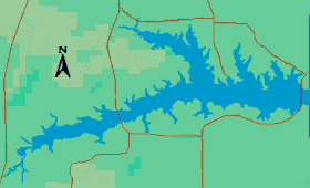
Lake Cypress Springs
Quick Links: Fishing Regulations | Angling Opportunities | Cover & Structure | Tips & Tactics
Lake Characteristics
Location: On Cypress Creek in the Cypress
River Basin 15 miles northwest of Pittsburg in Franklin County
Surface area: 3,461 acres
Maximum depth: 56 feet
Impounded: 1970
Water Conditions
Current Lake Level
Conservation Pool Elevation: 378 ft. msl
Fluctuation: 2-3 feet
Normal Clarity: Clear
Reservoir Controlling Authority
Franklin County Water District
(903) 537-4536
Aquatic Vegetation
Covers less than 10% of the lake's total surface area
Predominant Fish Species
Lake Records
Stocking History
Latest Survey Report
Lake Maps
Commercial maps may be available.
Fishing Regulations
A Triploid Grass Carp Permit is in effect on this lake. If a grass carp is caught, it must be immediately returned to the water unharmed. All other species are managed under statewide regulations.
Angling Opportunities
The largemouth bass population is moderately abundant with good numbers available for harvest. Spotted bass are present in moderate densities. Bluegill and redear are the dominant sunfish and moderate numbers of quality-size fish are available to anglers. Channel catfish are present in good numbers and provide excellent fishing opportunities. The white bass population can be can be described as high density with moderately high numbers of harvestable fish. White and black crappie are present and provide an excellent fishery.
| Species | Poor | Fair | Good | Excellent |
|---|---|---|---|---|
| Largemouth Bass | ||||
| Spotted Bass | ||||
| Catfish | ||||
| Crappie | ||||
| White Bass | ||||
| Sunfish |
Fishing Cover/Structure
TPWD and partner organizations have installed fish habitat structures in this lake. Additional habitat is found near boat houses, terrestrial brush and trees in shoreline areas, and rip rap along the dam.
Use the Habitat Structure Viewer for an interactive map of fish habitat structures and downloadable GPS coordinates.